Ward Division by Charter

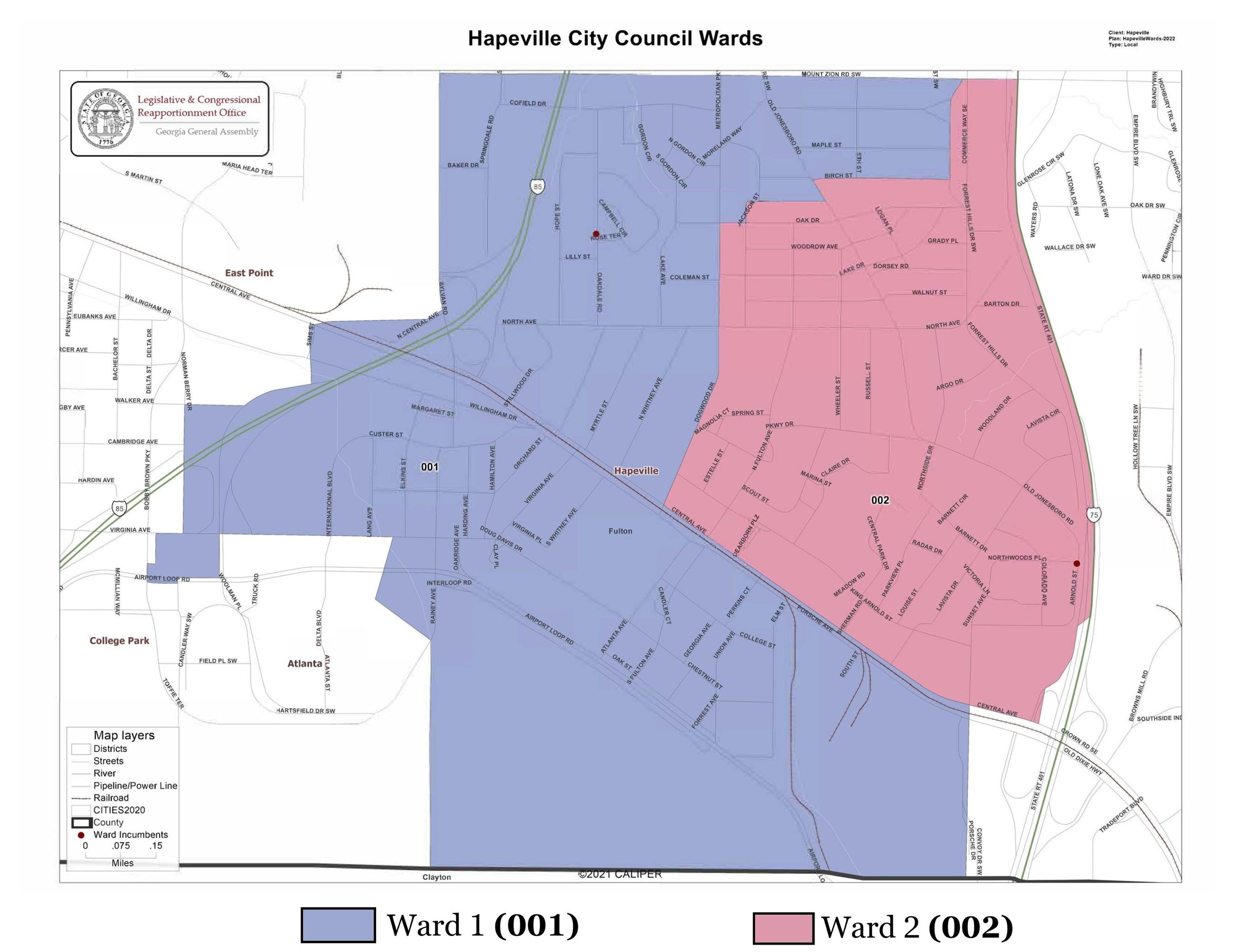
The City Charter provides that the City be divided into two wards (Section 2-3-18).
Ward No. 1 shall consist of all of the area of the City of Hapeville south of the railroad tracks at Central Avenue and all of the area of the city west of the centerline of Dogwood Drive, all of the area east of Dogwood Drive beginning north of Oak Drive from Jackson Street to Old Jonesboro Road, continuing north on Old Jonesboro Road to Birch Street and ending at Forrest Hills Drive, being the area formerly known as Ward 1.
Ward No. 2 shall comprise the area north of the railroad tracks on Central Avenue and east of the centerline of Dogwood Drive, south of Jackson Street from Old Jonesboro Road to Birch Street, and ending at Commerce Way, being the area formerly known as Ward 2.
Click here to download the PDF Ward Map.